See What Your Panels Can't Tell You
Defects That Ground-Level Inspection Misses
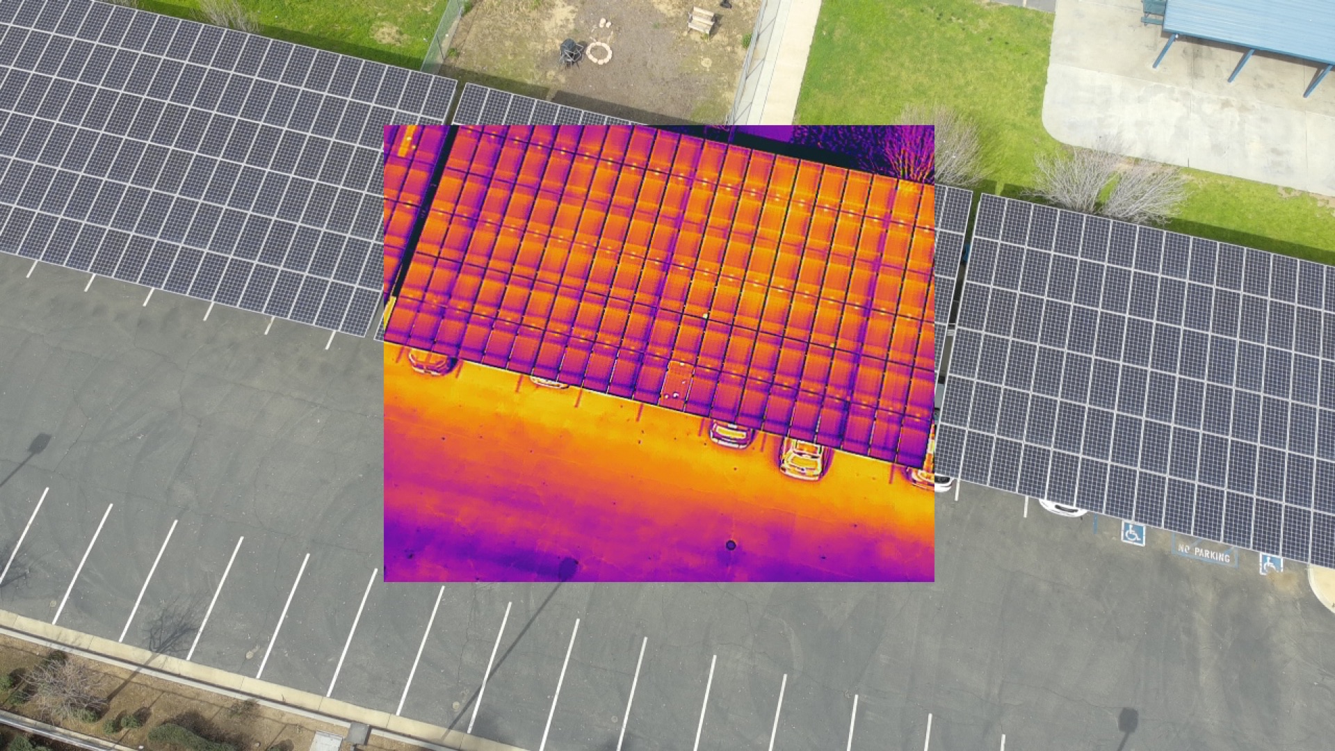
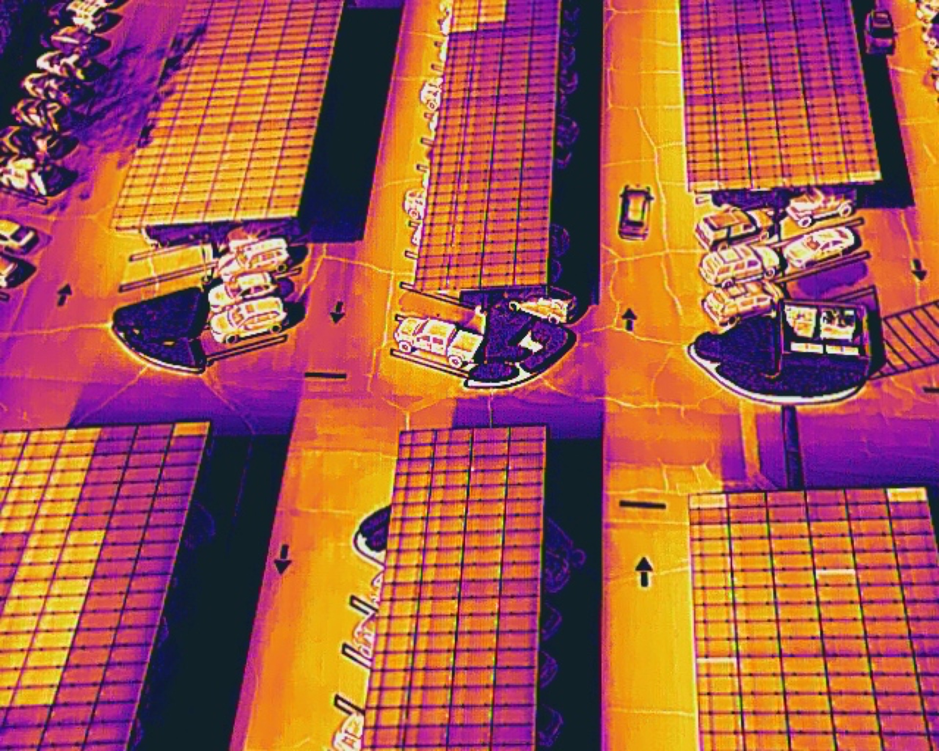
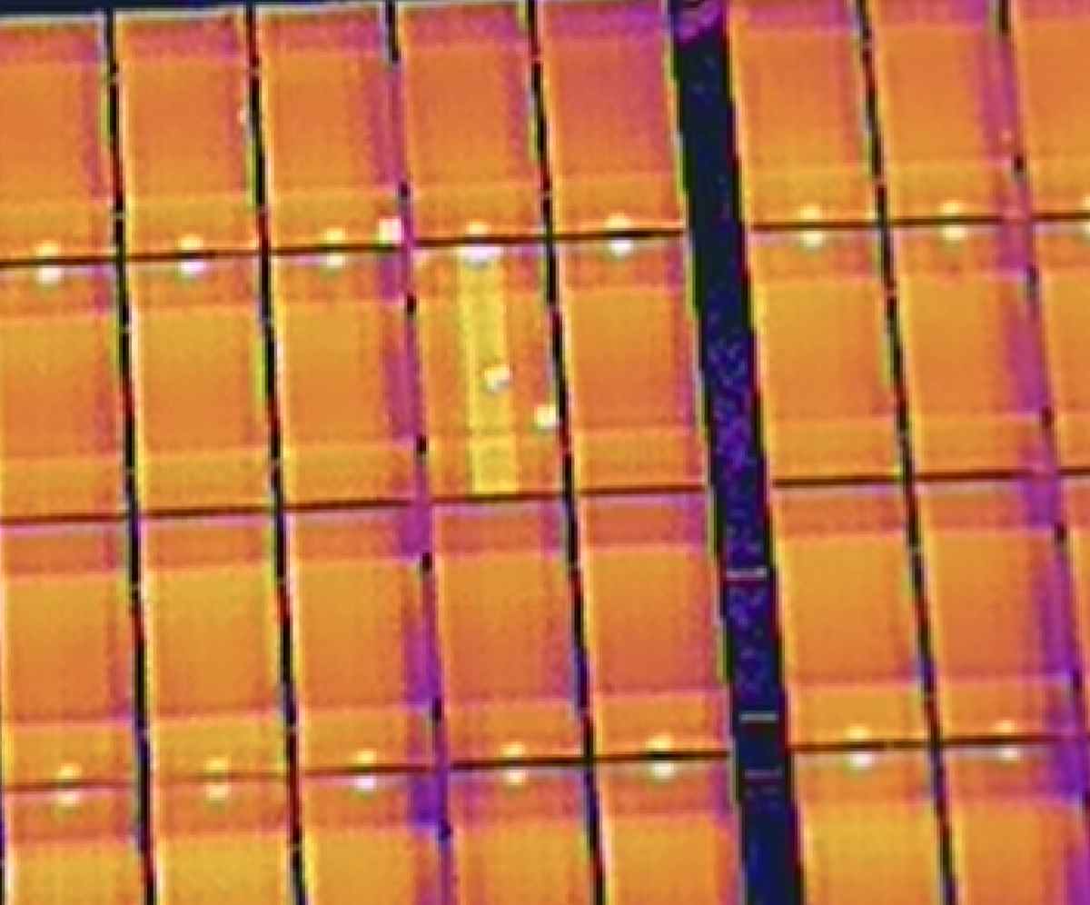
Hotspots, failed strings, and underperforming modules often go undetected for months — degrading output across your array without any visible indication from the ground.
A single aerial thermal scan covers your entire installation and surfaces the issues that production data alone can only hint at. Most operators recover the cost of inspection through improved output within weeks.
Half
Day On Site
100%
Panel Coverage
GPS
Tagged Defects
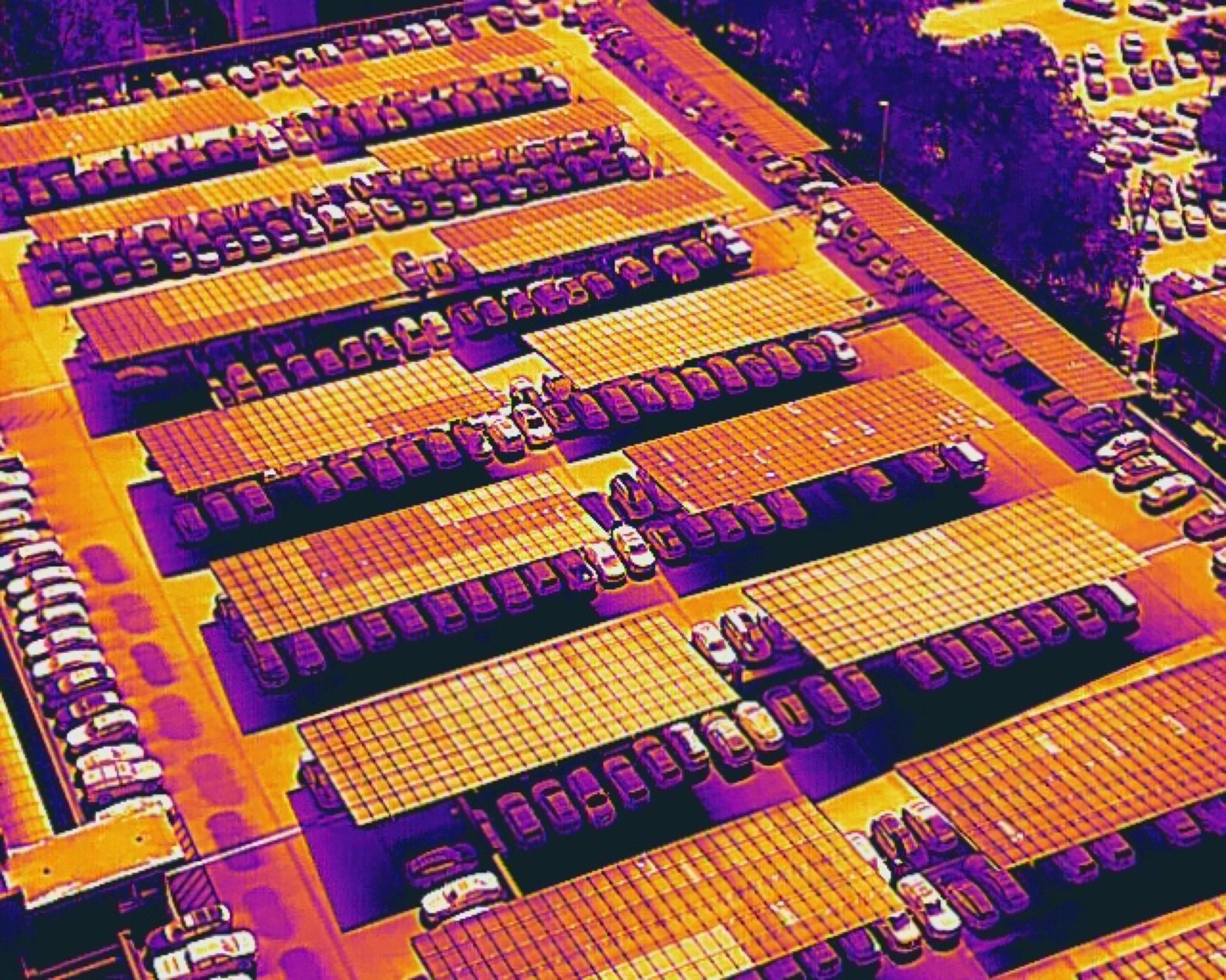
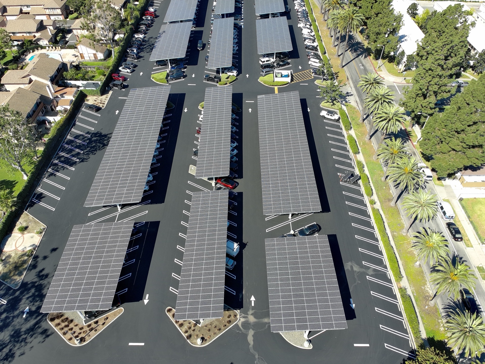
Thermal scan of a commercial solar carport — color variations reveal underperforming modules
What You Get
A clear, actionable report — not raw data you need to interpret.
Full Thermal Map
Complete thermal orthomosaic of your entire array. Every panel captured and stitched into a single, high-resolution image.
Defect Report
Every hotspot, failed string, and anomaly cataloged with GPS coordinates, severity classification, and recommended action.
Aerial Documentation
High-resolution RGB imagery of your entire installation for visual reference, planning, and before/after comparison.
How It Works
Schedule
Tell us about your site. We'll coordinate timing and logistics — most inspections are scheduled within a week.
Fly
We fly your array with a thermal sensor. The whole thing takes half a day, with zero disruption to your operations.
Report
You get a clear report with every issue mapped, classified, and ready for your crew to act on. No interpretation needed.
Request an Inspection
We'll assess your site, fly the array, and deliver a complete thermal analysis — typically within a week of scheduling.
Schedule an InspectionFAA Part 107 Licensed
Thermal + RGB Sensor
Fully Insured
Southern California